Unleashing the Skies: The Benefits of Environmental Monitoring and Research with Drones - 018
The topic of the environment can be polarizing but I think we can all agree from a general perspective there are practical ways to preserve the Earth for future generations and drones can be part of the solution. These cutting-edge technologies are revolutionizing the field of environmental monitoring and research. Among these innovations, drones have emerged as powerful tools in the hands of experienced environmental drone pilots. Offering unparalleled access, versatility, and efficiency, drones are transforming the way we collect data, analyze ecosystems, and address environmental challenges. In this article, we explore the numerous benefits of using drones for environmental monitoring and research, underscoring their potential to enhance our understanding and conservation efforts.

1. Unparalleled Access:
Drones grant researchers unprecedented access to remote and inaccessible areas, revolutionizing the way data is collected. From dense forests and rugged terrains to fragile ecosystems and wildlife habitats, drones can navigate challenging environments without disturbing the natural balance. By reaching places previously out of reach, environmental drone pilots can gather comprehensive data on biodiversity, habitat health, and environmental conditions that would have been otherwise impossible or highly costly to obtain.

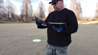
Source: Remote Pilot Association (TC Freeman)
2. Efficient Data Collection:
Traditionally, environmental monitoring involved manual data collection, which is time-consuming, labor-intensive, and often limited in scope. Drones, equipped with advanced sensors and imaging technologies, streamline the process by efficiently capturing vast amounts of high-resolution data in a fraction of the time. By autonomously flying predefined routes or employing intelligent algorithms, drones can cover large areas with minimal human intervention. This efficiency significantly reduces costs, enhances data accuracy, and allows researchers to gather a wealth of information in a shorter timeframe.
3. High-Resolution Imaging:
One of the key advantages of using drones for environmental monitoring is their ability to capture high-resolution imagery from various angles and altitudes. Equipped with sophisticated cameras, multispectral or thermal sensors, drones can provide detailed visual representations of landscapes, vegetation health, water quality, and more. These precise and up-to-date images enable researchers to detect subtle changes, monitor trends, identify ecosystem disturbances, and assess the impact of environmental factors on different species, facilitating timely conservation efforts and informed decision-making.
4. Enhanced Environmental Assessment:
Drones contribute to more comprehensive environmental assessments by integrating diverse data sources. By combining aerial imagery with GIS (Geographic Information System) technology, satellite data, and ground-based measurements, researchers can create detailed 3D models, map habitats, analyze land use patterns, and monitor changes over time. Such holistic assessments provide valuable insights into ecosystem health, biodiversity hotspots, pollution sources, and deforestation, enabling policymakers and conservation organizations to develop targeted strategies and mitigate environmental risks effectively.
5. Putting Technology in more Hands:
Another advantage of drones is that this technology can be utilized by a greater number of people thus gaining the ability to gather a broader amount of data. Drones do not require the amount of certification and expenditures that their manned counterparts require. An organization can start utilizing a drone by simply earning FAA Remote Pilot certification (Part 107), which is done by studying and taking a test, called a Knowledge Test at an FAA approved testing center. Once Remote Pilot certification has been earned the only remaining task is to learn to fly and/or program the specific drone used for environmental monitoring.
Conclusion:
Harnessing technology to advance our understanding and conservation efforts becomes increasingly crucial. Drones have emerged as indispensable tools for environmental monitoring and research, offering unmatched access, efficiency, and data quality. By employing drones, experienced environmental drone pilots can delve into remote areas, collect extensive data, and generate detailed insights that inform evidence-based conservation strategies. The integration of drones into environmental research holds immense potential for researchers and the drone industry that will allow us to pass along a healthy planet to the next generation.
TC Freeman is the Chief Instructor for the RemotePilotAssociation.com (RPA) and has a passion for helping recreational and commercial drone pilots learn to fly and earn FAA commercial Remote drone Pilot certification through live, hybrid or self-study courses.
Join us for our annual JUNE-JULY New Membership “OPEN HOUSE,” a FREE-no obligation bi-weekly webinar where we discuss drone business, certification, and re-currency. Email us to RSVP.
#drone, #dronephotography
Copyright 2023, Remote Pilot Association (TC Freeman)
Comments
Post a Comment